Fight for the Bight
Annual review 2019: Habitat loss and biodiversity
To stem the tide of extinctions, the logging of native forests and deforestation needs to stop.
Up and down the country the Wilderness Society is working hard to put an end to the destruction of our forests and protect the remarkable wildlife that lives in them.
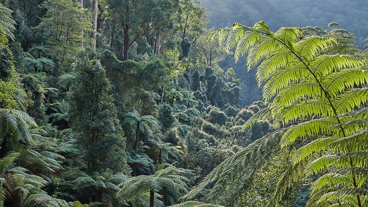
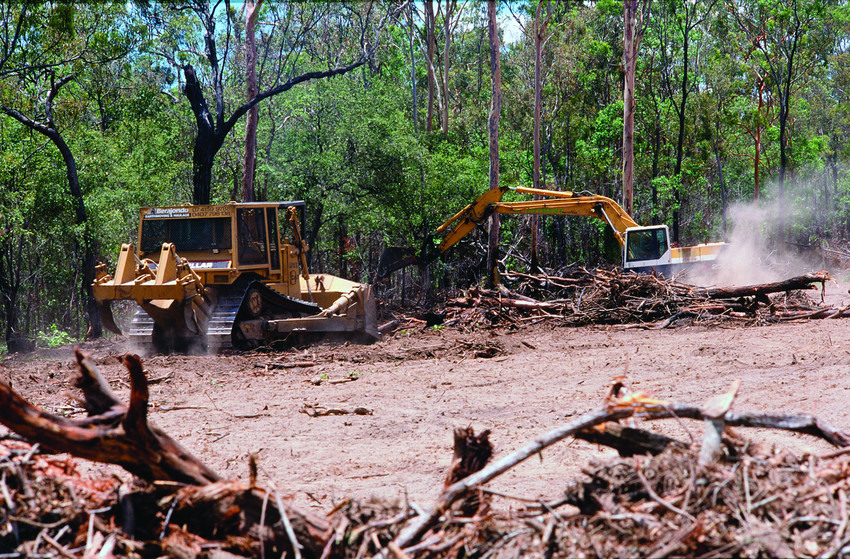
Our forests filter our water, purify the air, provide homes for countless species and safely store carbon dioxide. And yet forests continue to be destroyed. In Queensland, vast swathes of bushland are bulldozed, while in Victoria stately old-growth forests are being turned into cheap office paper.
But we are working to safeguard these vital habitats. This year, together with community group GECO (the Goongerah Environment Centre), the Wilderness Society appointed four advocates for the Emerald Link proposal with the aim of preserving the vast, continuous tracts of forest left in East Gippsland, Victoria.
"East Gippsland is like nothing else," says Victorian Campaign Manager Amelia Young. "It is the last place on mainland Australia with intact vegetation from alps to coast, a type of ecosystem connectivity that’s becoming increasingly rare on a global scale."
The Emerald Link will reinvigorate regional communities in East Gippsland through investment in nature-based tourism and land management programs. The advocates live and work in Victoria’s far east, where old-growth forests are still logged by the state government. "They are busy meeting with local businesses, community groups and local government to bring the Emerald Link concept to fruition," says Amelia. "Local input and ownership is front and centre."
Meanwhile, thanks to community advocacy, member support and direct lobbying at last year’s state election, the Victorian state government committed funding to plan and establish the Sea To Summit trail in East Gippsland, a multi-use recreation trail from alpine environments, through ancient rainforest and coastal heathlands to the coast. "Logging has now been removed along the trail after we showed the government how it would destroy the amenity and values of the area," says Amelia.
The deforestation crisis
Australia is in the midst of a biodiversity catastrophe, deforestation for agriculture a main driver with a football-field sized area of forest and bushland being destroyed across the country every two minutes. Most of this deforestation is happening in Queensland, with NSW, WA and the NT also seeing alarming increases.
"Last year we ran a successful campaign to have new deforestation laws introduced in Queensland, and we are yet to see whether those laws have changed enough on the ground," says National Nature Campaign Manager Jessica Panegyres. "We’ve been successfully challenging mass deforestation proposals in Queensland, WA and the NT, and campaigning to have stronger protections for koala habitat in South East Queensland.
"We ran community campaigns for stronger deforestation laws in the lead up to the federal and NSW state elections, and we continue to expose deforestation issues regularly in the national media," says Jessica. "We’ve also been working to identify the industries driving deforestation, so that we will be able to pressure them to employ forest-friendly practices.
"In Queensland, spatial mapping revealed that the beef industry is linked to 73% of all deforestation and land clearing in the state. This also showed how much habitat crucial to threatened species like the koala, was being cleared under our woefully inadequate federal environment laws.
"It’s the first time anyone in Australia has done that kind of mapping and it lays the groundwork for the next phase of our campaign that will focus on eliminating deforestation from the beef supply chain.
An eye in the sky
GIS mapping is now integral to the Wilderness Society’s work
"As a spatial scientist, I love data. Without it, it’s impossible to get the full picture on what industries are causing habitat destruction. A lot of people don’t realise this, but national data on habitat destruction for threatened species in most states is woeful and often non-existent. Only Queensland has a reliable annual data set and what’s more it’s a global deforestation hotspot." - Rachel Fletcher, Environmental GIS Analyst