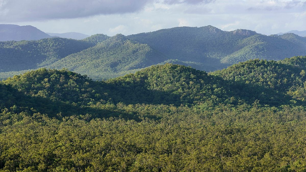
Deforestation
Our web-based app is uncovering deforestation as it happens using the latest satellite imagery.
Watch on Nature is our new people-powered platform that's exposing clearing across the country to end Australia's deforestation crisis.

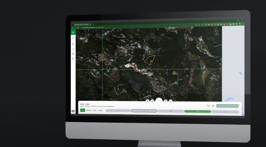
Watch on Nature is a website application that assists with detecting and exposing deforestation across Australia. It has a user-friendly interface that displays Sentinel-2 satellite imagery from various dates.
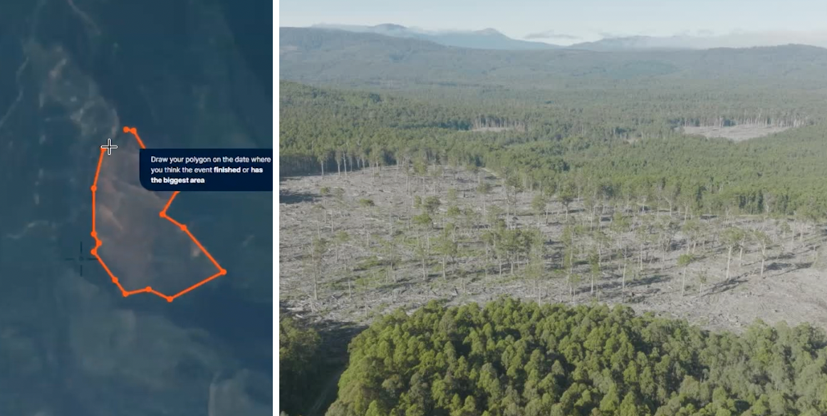
In-built tools enable volunteers to detect changes in vegetation cover. They can then send the Wilderness Society an alert of potential clearing (or other change).
There is also computer-automated vegetation change detection built into Watch on Nature that will be further developed to send alerts to the Wilderness Society if clearing is detected in any of the focus zones. Focus zones are areas of concern that the Wilderness Society is watching with the help of the community and Watch on Nature, and include Queensland's forest and bushland, WA's Northern Jarrah Forests, Victoria's tall forests and Tasmania's forests.
Watch on Nature will assist in uncovering deforestation across Australia, land-clearing compliance and provide a training database of detected clearing events in Australia to further refine the auto-detection tools.
Register now to explore Watch on Nature
Wilderness Society scientist Rachel Fletcher is determined to keep Australia’s remaining forests safe. The sheer vastness of this continent and the remoteness of some of its most special places means it's very hard to keep a tab on the health of forests and bushlands without satellite imagery.
Rachel uses satellite mapping to track and report on the loss of forests and bushland across the continent. She helped develop the cutting-edge technology behind Watch on Nature that will reveal rampant deforestation by the beef, paper, timber and mining industries.
Watch on Nature gives groups in regional areas, remote First Nations communities, ranger groups and citizen science organisations the ability to access data on the extent of forest and bushland clearing, or fire extent, in near real-time.
“When you see the massive scale of years of deforestation from space, it is really confronting. More people need to see what’s happening. That’s why we’ve developed a citizen scientist platform that helps us keep an eye on what’s happening to forests in real time. And it gives supporters and communities the tools to expose deforestation.”—Geospatial Analyst, Rachel Fletcher.

This prompted us to make an inquiry with the state government about the legality of this clearing, which spanned approximately 110 hectares.
We know that the majority of the destruction we’re witnessing through Watch on Nature is technically legal due to dodgy loopholes in the current laws, as well as historical "approvals" or codes. Sadly, the deforestation at Einasleigh Uplands was no different. These loopholes are big enough for dozers to drive through.
Our inquiry about this clearing also helped reveal that the Queensland government is not thoroughly updating or correcting its mapping.
The vegetation on the property at Einasleigh is listed in various government datasets as ‘High Value Regrowth’, ‘Mature Regrowth’, or ‘Category C (regulated vegetation)’—but we know it was cleared in 2016-17. This means it should have been listed as High Value Regrowth forest, before it was destroyed again in November.
Our findings were published in the report What’s at ‘steak’?, which uncovered more than one million hectares of forest was cleared to make way for beef from 2014-2019.In September 2022, Watch on Nature users alerted us to the clearing of at least 3,700 hectares on land owned by the Consolidated Pastoral Company at its Wrotham Park station.

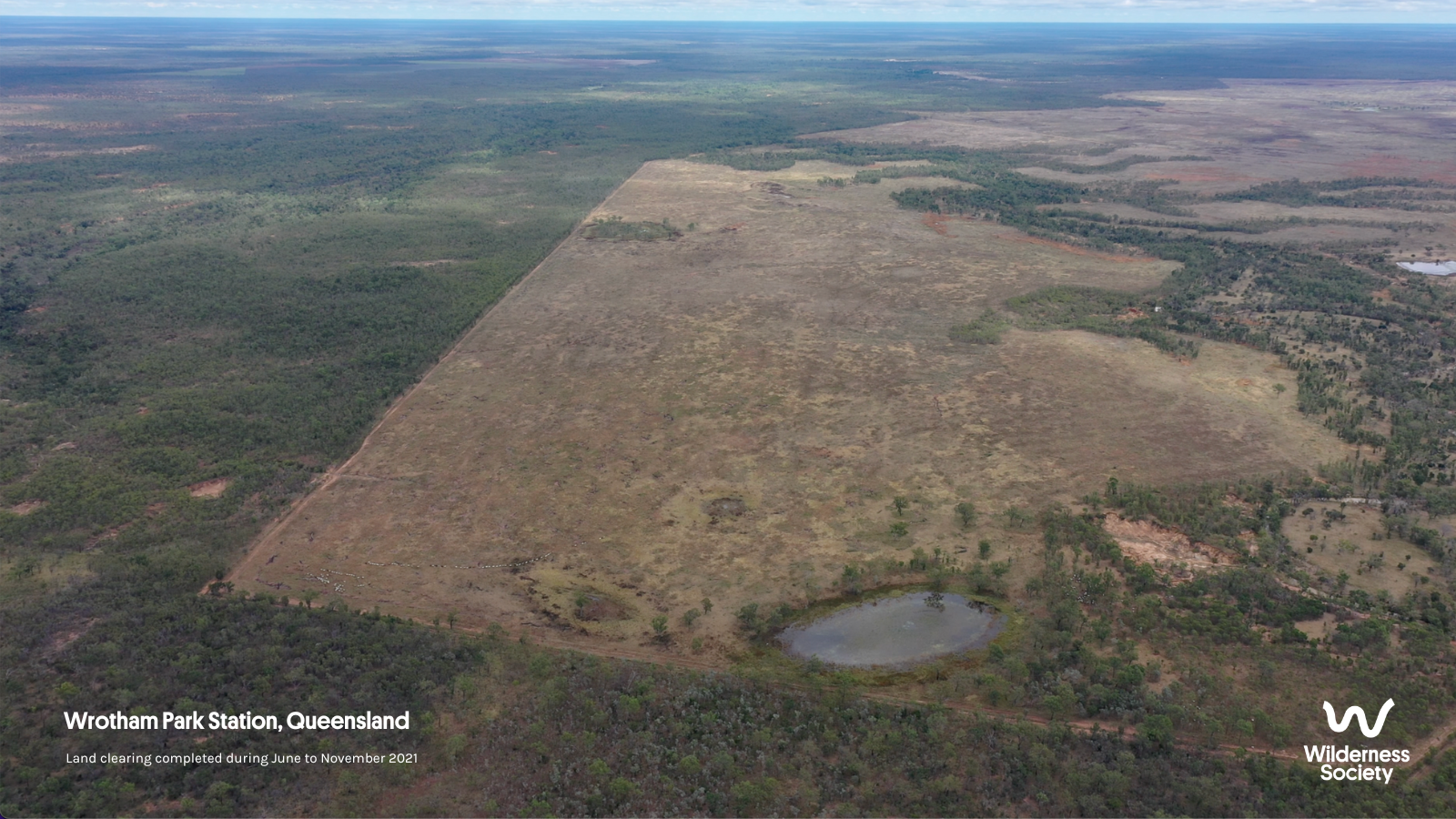
Wilderness Society in partnership with Queensland Conservation Council managed to land a national news story on the ABC about the deforestation at Wrotham station, showing Australians what "legal" deforestation can look like.
In October 2023, Wilderness Society was invited to present Watch on Nature at Google’s annual Geo for Good summit at its headquarters in Silicon Valley! ENGOs, universities and research labs and some of the biggest geospatial brains from across the world shared the latest advances, ideas and research in geospatial science, new satellite tech and monitoring systems—including our very own GIS Analysts, Rach and Ola!
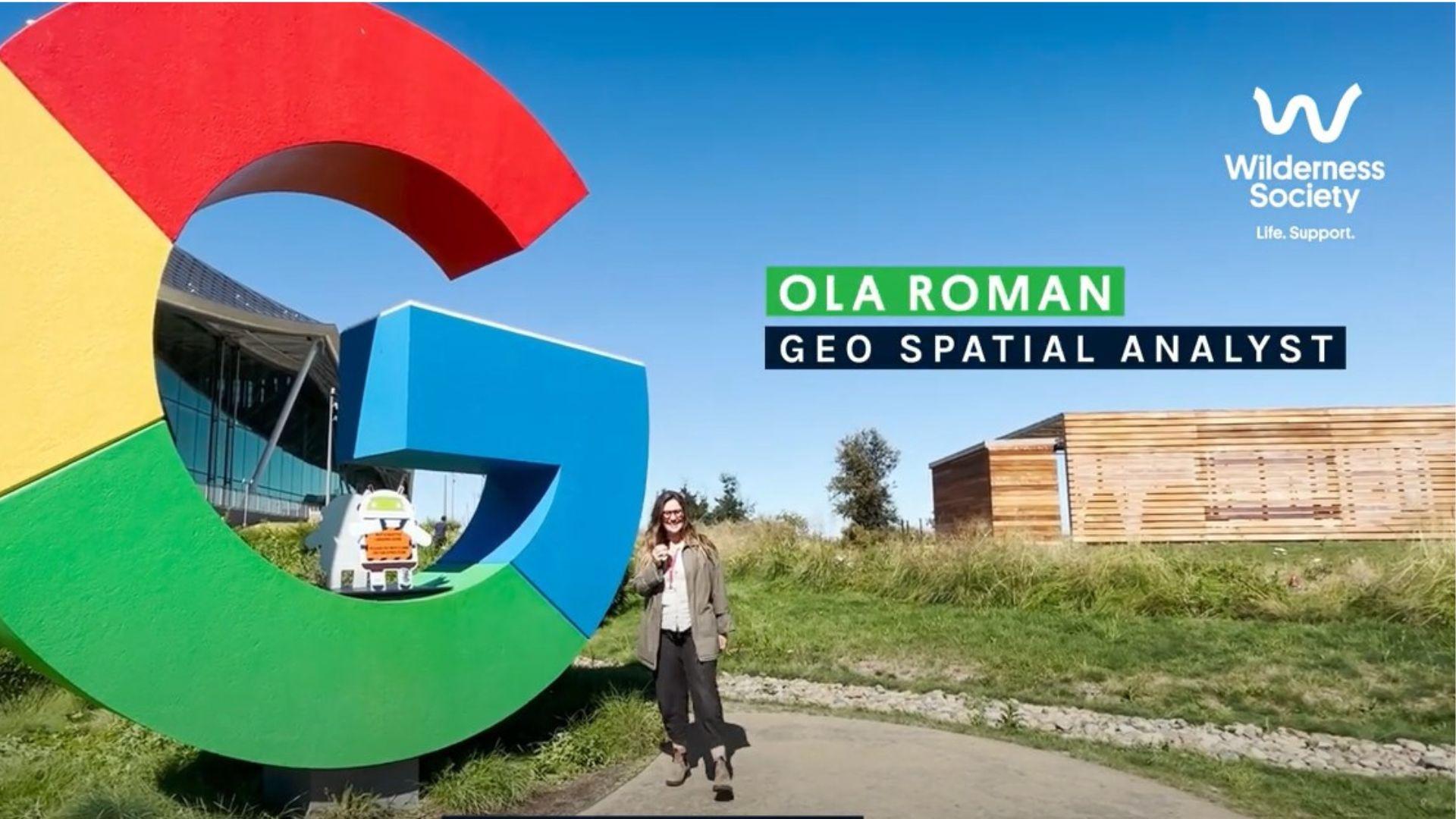
“We demonstrated how Watch on Nature works and spoke about the deforestation crisis unfolding in Australia, and had folks from all over the world interested in collaborating with us in future,” says Ola. “The sit-down sessions with Google Earth professionals were incredibly valuable, because we got to discuss how to make the platform even more powerful and impactful for nature.”
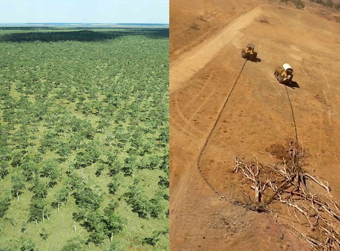
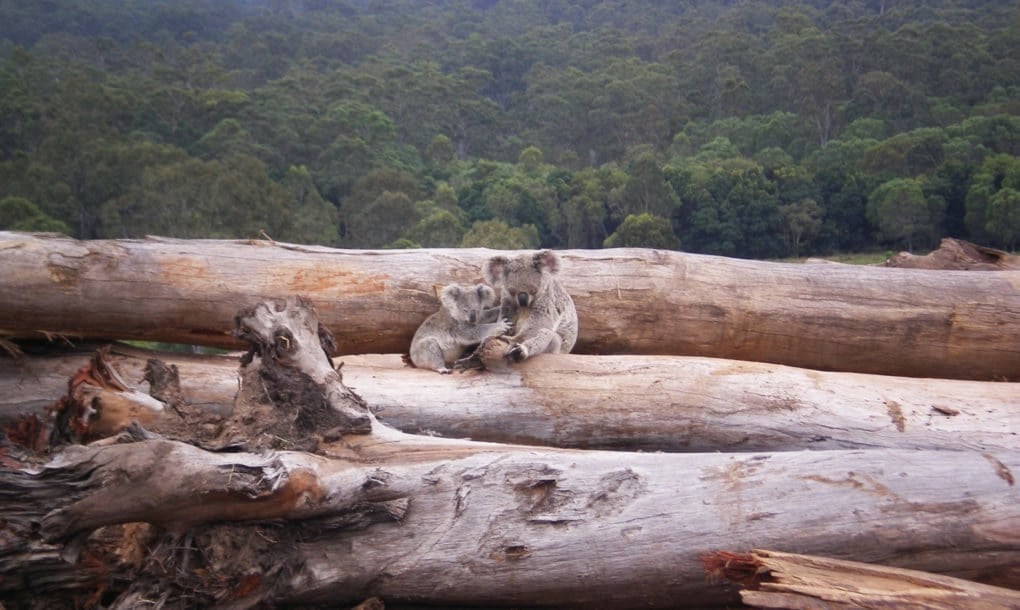
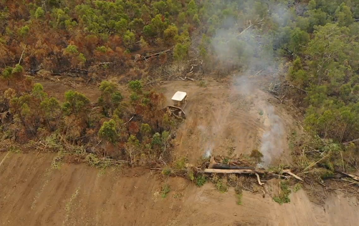
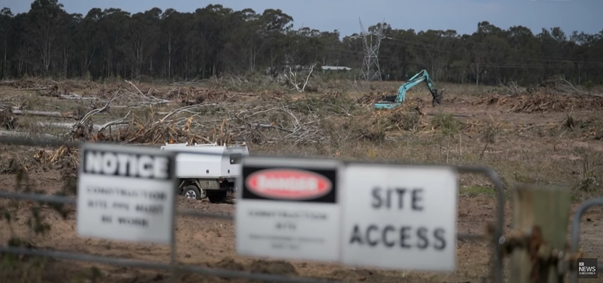
It’s important that Australians get to see what’s being destroyed—including if bulldozers were used to knock down trees, what the tree cover looked like, and whether the bushland was native vegetation likely to have been home to vulnerable wildlife.
We’ll continue to expose large-scale deforestation throughout Australia using our people-powered program, Watch on Nature, and you can too! Fill out the form below to get involved.